
boulder gardens & babcock falls
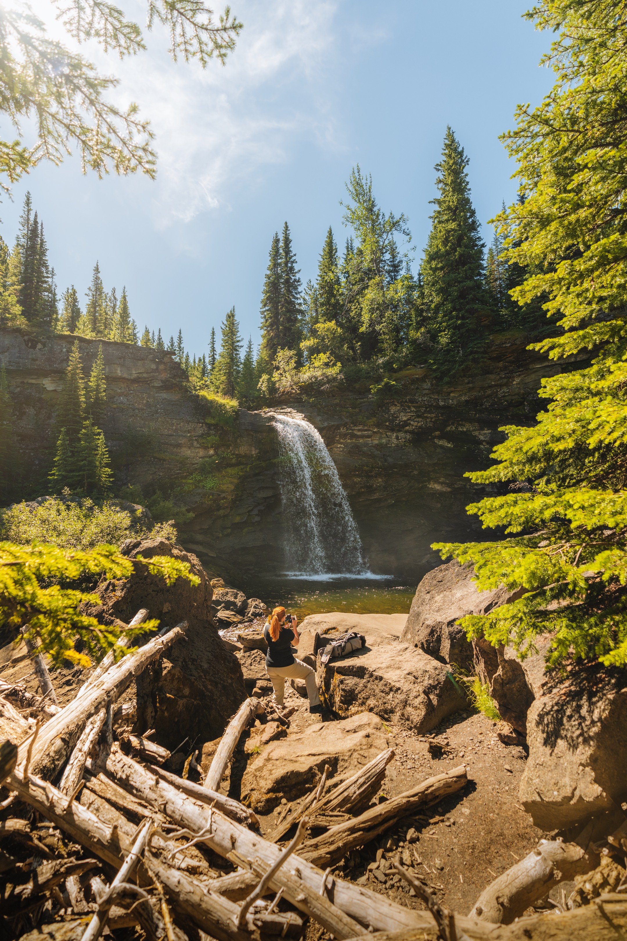
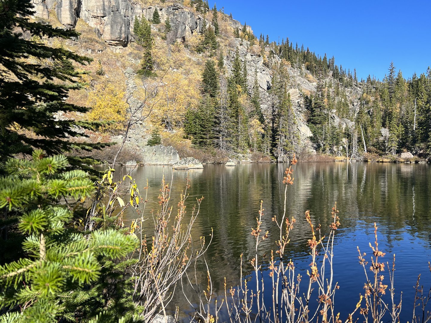
Beginning near the Peace River Coal Mine, the Boulder Gardens trail will bring you to a breathtaking formation of rock pinnacles located on the southeastern slopes of Mount Babcock. The Babcock Falls hiking trail winds through beautiful sub-alpine meadows and leads to a stunning waterfall that cascades into a deep, inviting pool.
Distance | Time:
Boulder Gardens: 4 km return | 2-3 hours
Babcock Falls: 2 km return | 1-2 hours
Trail Rating:
Boulder Gardens - Moderate
Babcock Falls - Easy


Features:
Unique rock gardens, scenery, caves, tarn, viewpoints, rock climbing.
Waterfall, swimming, sub-alpine meadows.
-

Trails
The short trek to Babcock Falls passes through a blend of pine and spruce forests, as well as subalpine meadows, until you reach the impressive 8-meter-high falls. These falls cascade down from a sandstone cliff into a pool below. Wooden boardwalks guide you through a distinctive wetland area, where you can observe wildflowers and fossilized logs.
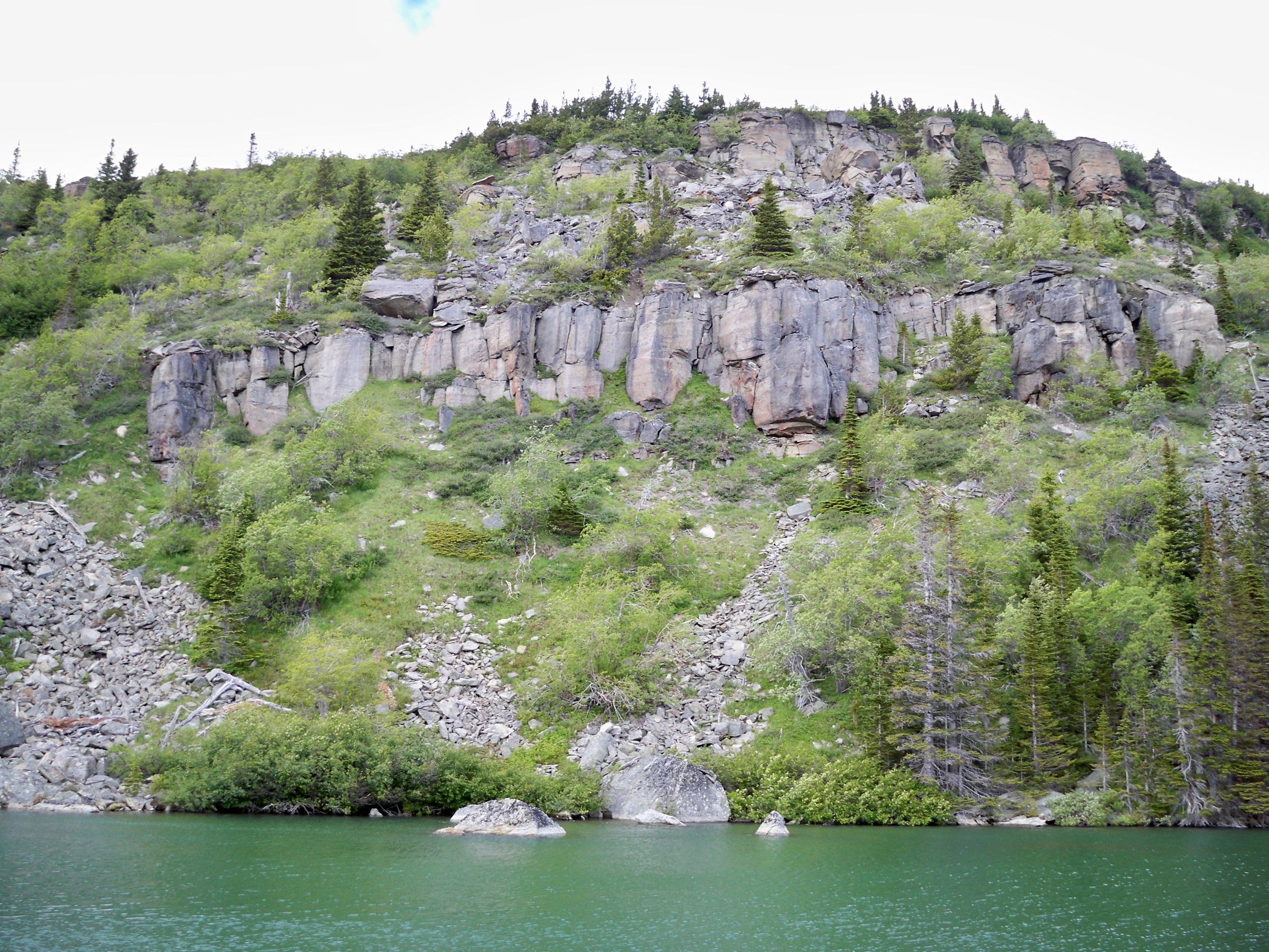
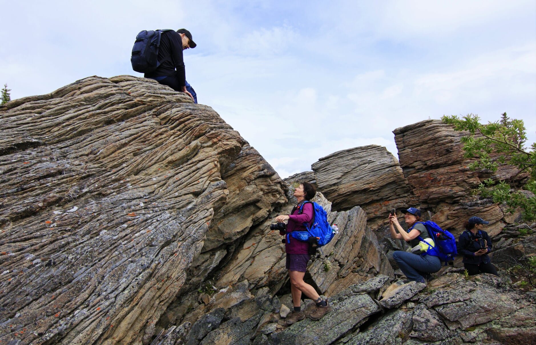
The Boulder Gardens trail takes you through towering rock pinnacles on Mount Babcock's southeastern slopes. It is recommended to hike the circular route counterclockwise, which leads you through a surreal landscape of rock pillars, slabs, and boulders. Be aware of the many cracks and crevices between the rocks, stay on the trail, and keep a close eye on children.
-

Trip Link
These trails are located in the Core Lodge area. The Core Lodge is a steel shed that has been converted into a day use lodge by the Tumbler Ridge Riders Snowmobile Association. The other popular destination in this area is the Shipyard-Titanic and Tarn and Towers Trails.
-

Geology
Babcock Mountain's summit is crowned by a thick layer of coarse-grained sandstone and conglomerate that was deposited in a high-energy freshwater environment during the Cretaceous Period. Underneath this layer are several older layers, some of which consist of softer siltstone or even softer kaolinite clay. Due to the Rocky Mountains' formation, the mountain's rock layers were exposed to immense forces and became tilted at an approximately 15-degree angle to the horizontal. Eventually, the upper layers, including the thick sandstone, slipped down along the kaolinite layer through a process known as "translational movement," causing them to gradually slide off the mountain's edge in multiple locations.
-

Winter Adventure
Boulder Gardens: Boulder Gardens can be explored on snowshoes - but be aware that the road to the trailhead is not plowed. Check with the Visitor Centre for current information.
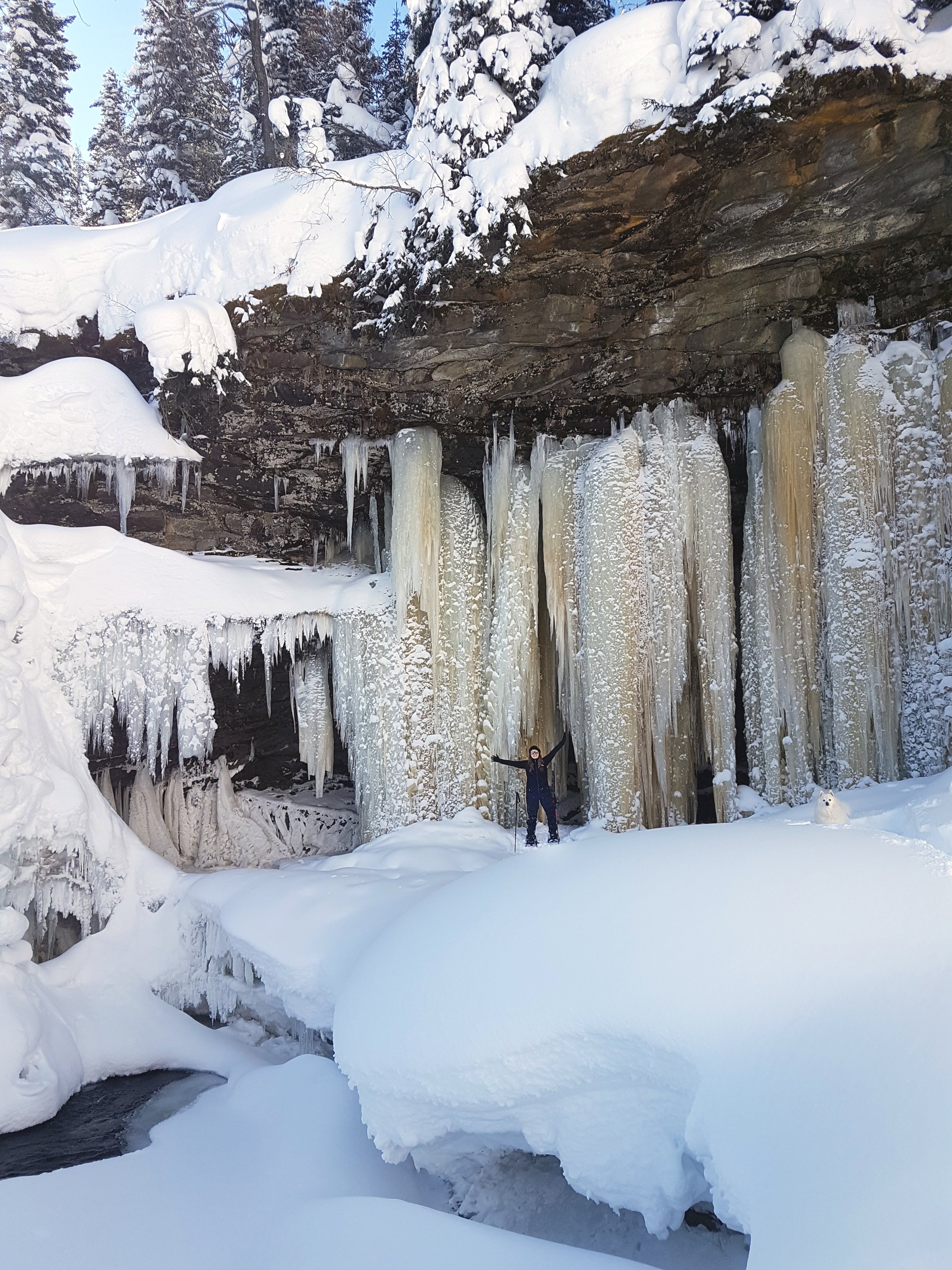
Babcock Falls: To the north of the falls, water seeps and drips from the crevices between the rock layers. During winter, these droplets freeze to create a stunning ice formations. As a result, Babcock Falls transforms into a popular destination for snowshoeing, cross-country skiing, and ice climbing.
-

Volunteer Work
The sub-alpine meadows remain consistently damp and many hikers walking the same trail would create boggy conditions which would make for an unpleasant hiking experience as well as lead to environmental degradation.
In 2014, the Wolverine Nordic and Mountain Society's volunteers enhanced the boardwalk section crossing the meadows. They built twenty-five sections in Tumbler Ridge, transported them to the trailhead, airlifted them by helicopter, and connected them while reusing certain components of the original boardwalks as foundations. The proceeds from the Emperor's Challenge Mountain Run supported this initiative.
-

Caution
Be aware of industrial traffic on road.
Boulder Gardens: Some scree sections that require simple scrambling. Rough route in places. There are deep crevices in places - use caution and always supervise children and pets.
Babcock Falls: The descent to the pool is very steep - use caution.
DIRECTIONS TO core lodge
From Tumbler Ridge, drive south on Hwy 52 (the Heritage Highway; the section heading south from town is known locally as the Boundary Road). The paved road passes the turnoff to Kinuseo Falls at km 12.7. Keep going straight on the Hwy 52 for another 6.8 km to a right turn onto the Core Lodge Road. This road is radio controlled - watch for industrial traffic. At 12.5 km, there is a fork. Take the right fork, following the sign saying “all other traffic”. The left fork is for mine traffic only. From the Heritage Highway, it is 14 km to the Core Lodge.


thank you to our partners


experience tumbler ridge unfiltered. tag #tumblerridge to show us your adventures.