Tepee falls
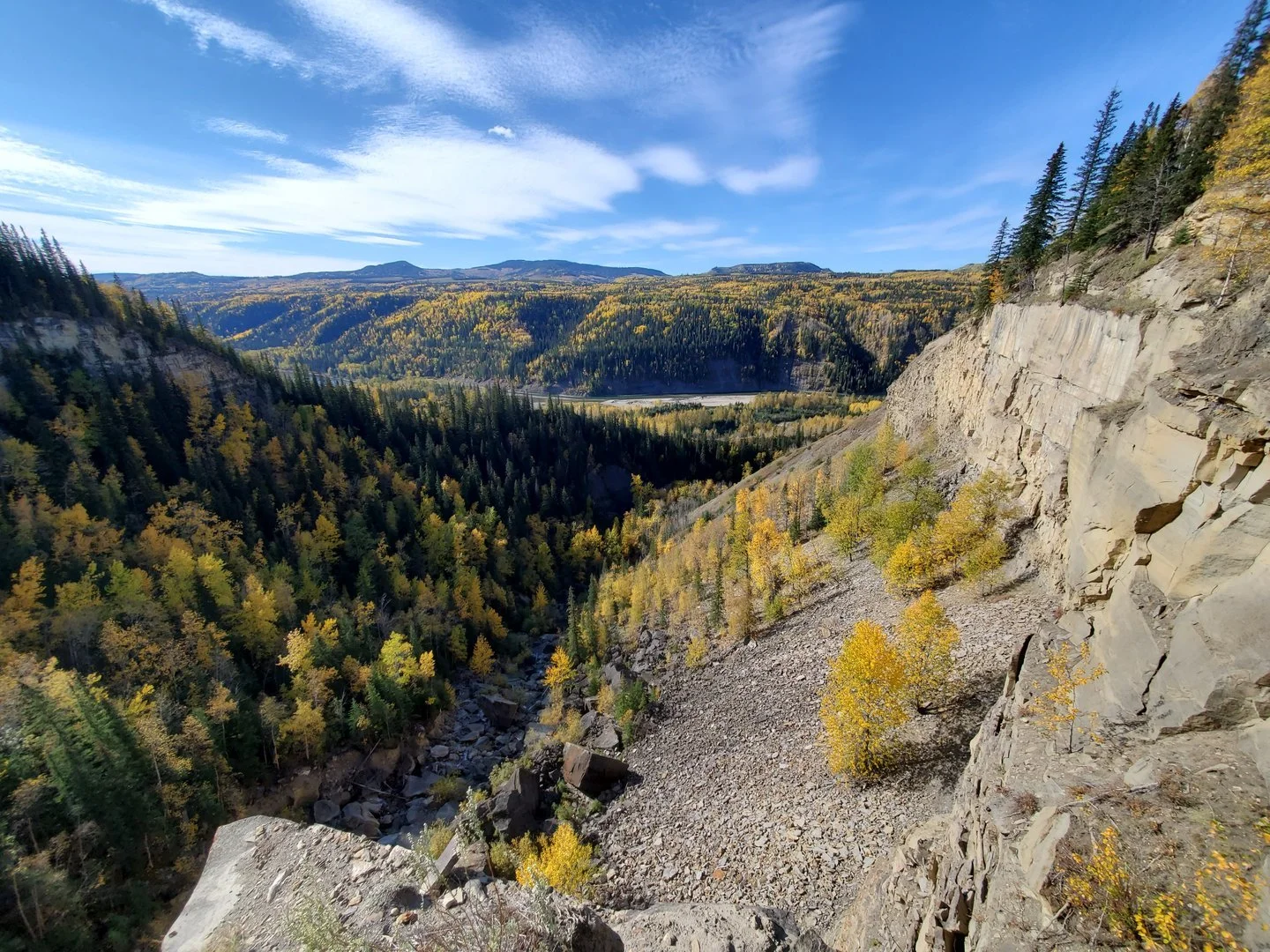
Welcome to the Tepee Falls trail, an enchanting journey through serene spruce and aspen forests, leading you to a breathtaking waterfall that gracefully plunges over a sandstone edge into a picturesque bowl of boulders. Immerse yourself in the awe-inspiring beauty as you take in the sweeping vistas of the expansive Murray River valley. This easy hike promises a memorable experience for nature enthusiasts and adventurers alike.
Distance | Time:
6 km return | 2-3 hours return
Trail Rating:
Easy

Features:
Waterfall and canyon.
Caution:
Unbarricaded drop-offs.
-

Trails
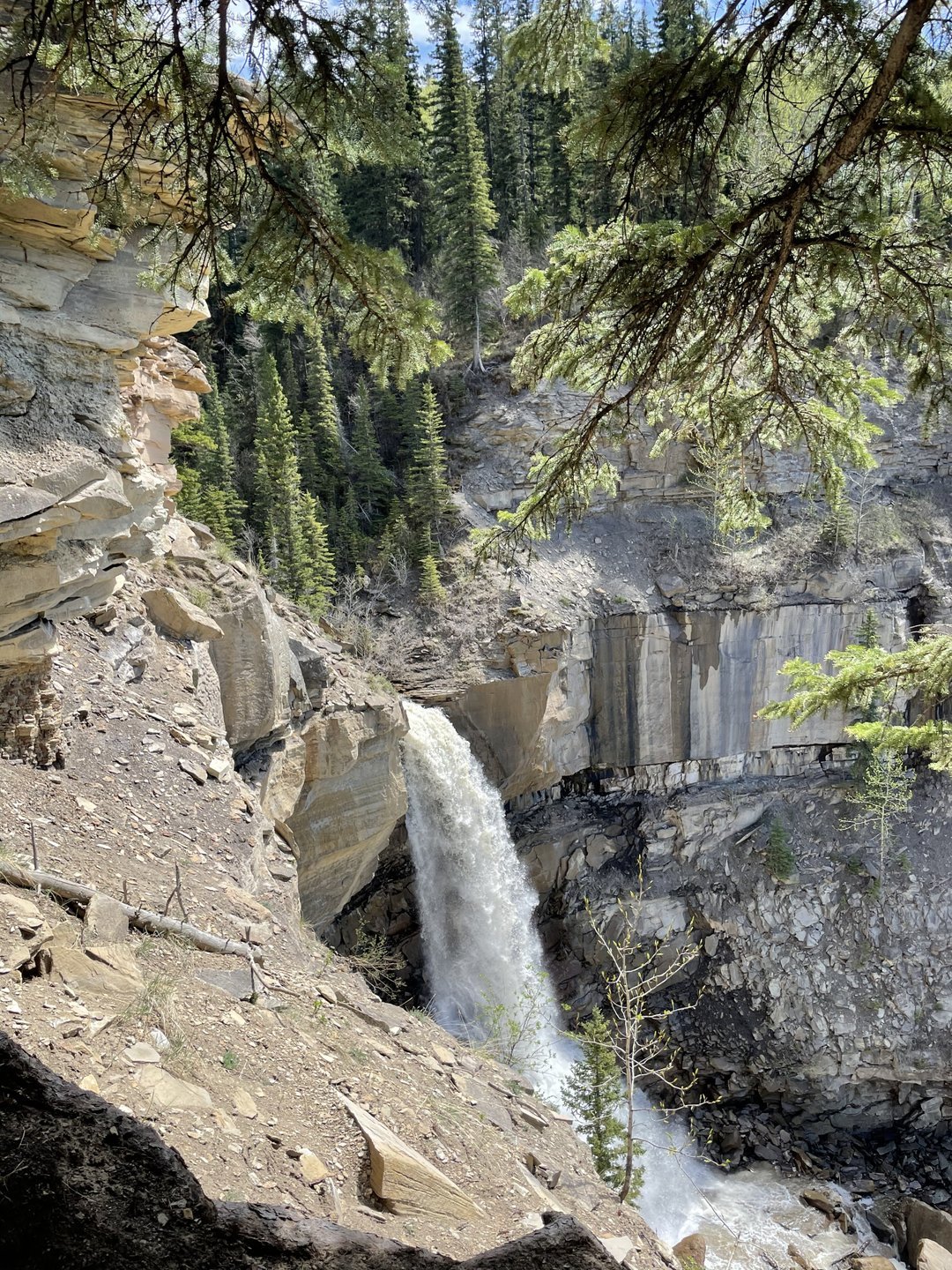
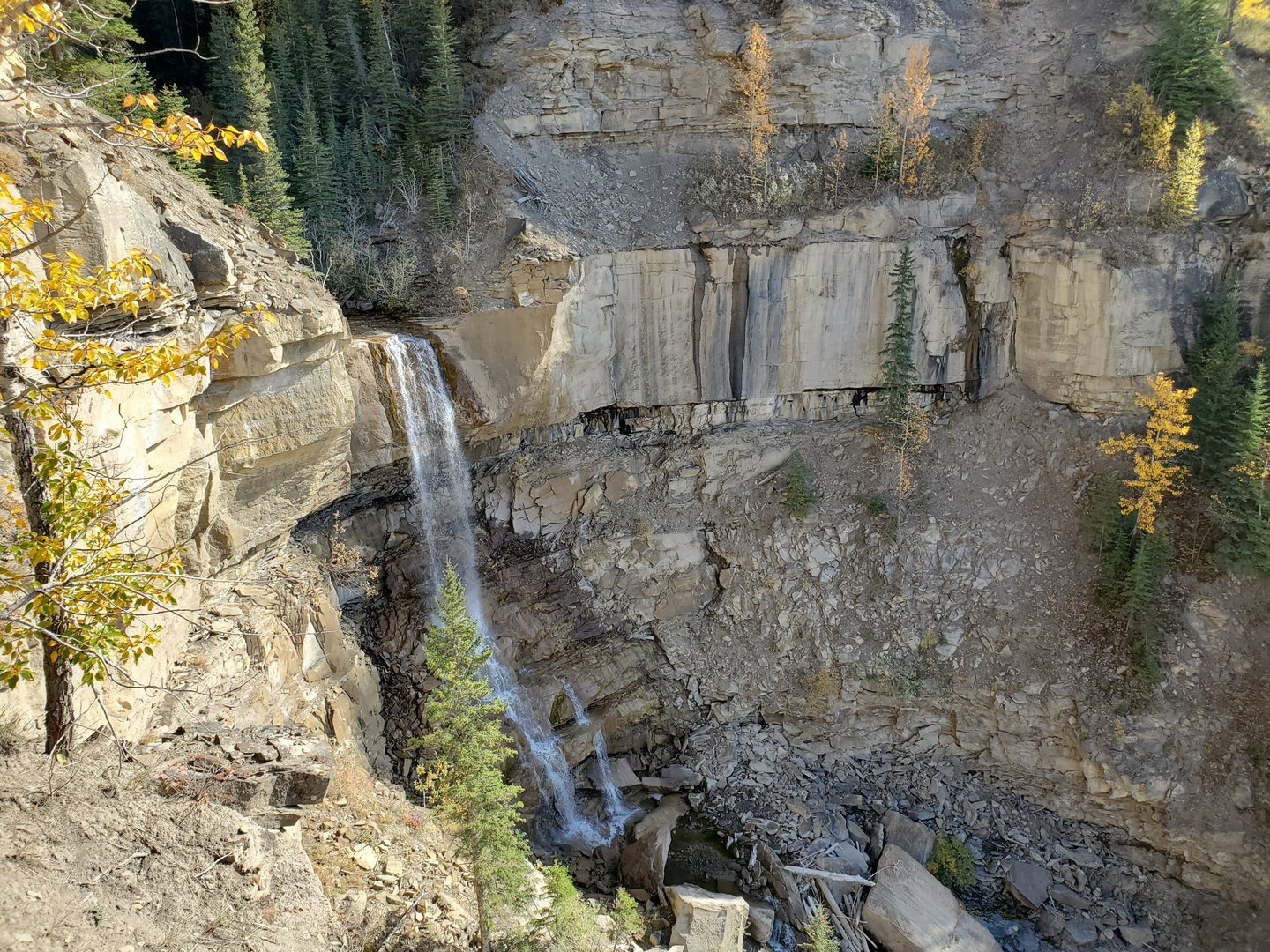
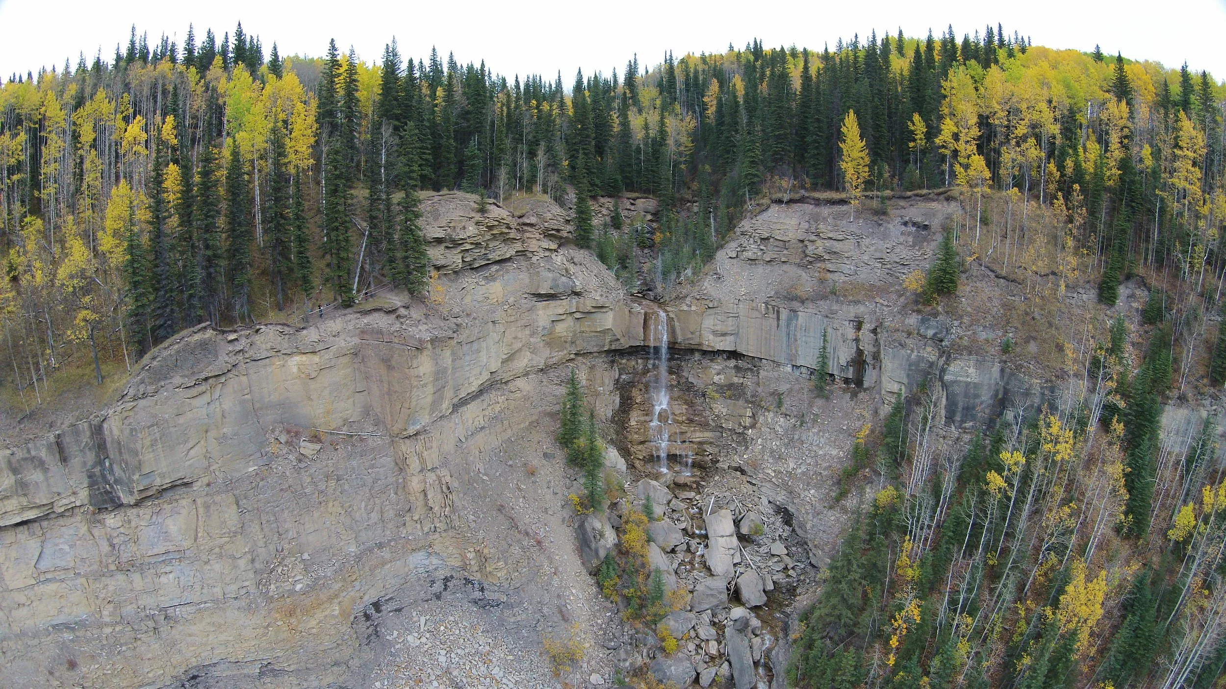
The trail to Tepee Falls starts across the highway from the signed parking area. After approximately 2.5 km, you'll reach a clearly marked junction, where a map indicates the trail ahead forms a loop. Take the left fork, leading you to a viewing site. From there, a branch trail veers left, guiding you to a vantage point above a smaller waterfall. Just over 100 meters downstream lies the main falls, accompanied by a trail that carefully navigates a steep drop—exercise caution in this area. Passing under a fallen spruce tree, the trail ascends to a promontory overlooking the falls. Please avoid approaching the edge and instead ascend the staircase to a safer viewpoint, offering views of the canyon below. Note that the staircase may become slippery and muddy in wet conditions.
-

Wildlife
Keep a watchful eye for mountain goats, an unexpected sight amidst the black shale cliffs of the lower valley. Thriving in steep terrain that provides safety from their predators, these remarkable creatures have found a home in this canyon, despite being approximately 40 km away from the nearest alpine mountains.
-

Fossils
Within Tepee Falls surroundings, remarkable layers of thick bedding offer insights into a dynamic and energetic environment, typically unfavorable for fossil preservation. Yet, nestled among the fallen blocks at the base of the falls, a few exceptional blocks showcase intriguing surface features. Notably, among these geological treasures lies a significant discovery made in 2009—the sole known dinosaur trackway within the Cardium Formation. These tracks, attributed to an ornithopod, provide a captivating glimpse into the ancient footsteps that once graced this remarkable landscape.
-

Ice Climbing
Tepee Falls stands as an awe-inspiring winter playground for skilled ice climbers seeking an exhilarating adventure. With its towering ice formations and challenging terrain, this majestic destination offers a thrilling experience for those equipped with the necessary skills. . BC Peace Region Climbers is a good resource for climbing information.
-

Geology
Witness breathtaking views as the creek takes a magnificent 15-meter plunge off the cliff, cascading into a mesmerizing array of boulders and sandstone remnants sculpted over time. These geological marvels, dating back approximately 90 million years, form a distinctive part of the Cardium Formation from the Upper Cretaceous Period, adding a distinctive touch to this natural wonder.
-

Caution
There are huge unfenced drop-offs, do not approach the edge and supervise children and pets closely.
DIRECTIONS TO TRAILHEAD
The trailhead is on Hwy 52 on the way to Dawson Creek. Head towards Dawson Creek and watch for the signposted parking area 35 km from Tumbler Ridge, on your right. A sign and map are at the trailhead. The trailhead is 5 km north of the trailhead for the Murray Canyon Overlook trail, a very worthwhile hike that has its own interpretive brochure. Many people make a day of it by hiking both trails. If you are coming from Dawson Creek, the Tepee trailhead is 62 km from the junction of Hwy 52 with Highway 97 to Chetwynd.


thank you to our partners


experience tumbler ridge unfiltered. tag #tumblerridge to show us your adventures.