bootski lake
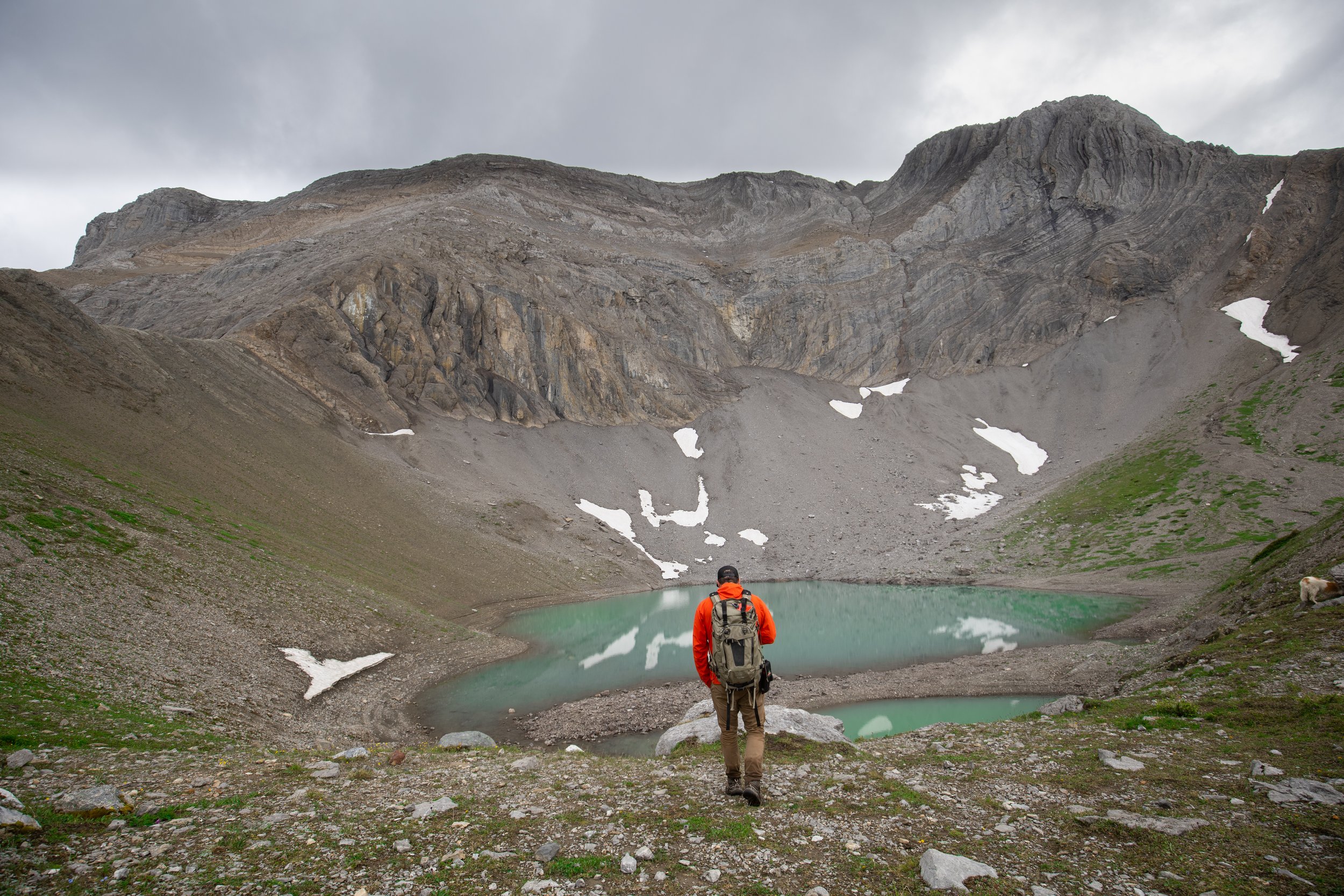
Nestled on the northern slope of Mount Wapitik, Bootski Lake is a breathtaking alpine tarn that offers stunning views of the surrounding steep slopes and majestic summits. This picturesque lake may be small in size, but it's a hidden gem waiting to be discovered by nature enthusiasts and adventure seekers.
Distance | Time:
11 km return | Full day
Elevation Gain: 550 m
Trail Rating:
Challenging
Features:
Spectacular alpine scenery,
small alpine lake, wildlife.
-

Trails
Bootski Lake is a challenging hike that will take 5-7 hours. The trail is 11 km long. Flagging marks the trail to the alpine, after which good route finding skills are required. Fog and snow may be encountered. Always be prepared for sudden weather changes in the alpine. When making the return trek from Bootski Lake, follow the open ridge, and watch closely for the rock cairn and sign which mark the point where the route makes a 90 degree right turn and descends into the forest. View the WNMS Hiker’s Guide for more information.
-

Skiing
During the winter months, the Bootski Lake area offers backcountry skiing opportunities. However, it's important to check with the Visitor Centre beforehand, as the road leading to the area may be inaccessible due to weather conditions.
-

Guided Tours
Bootski Lake is a challenging hike with quite an elevation gain. Once you reach the alpine, it is beneficial to have route-finding skills. Check with our local guides as they may have an option to do a guided and/or group hike.
-

Trip Link
There are two worthwhile side trips in the area. The short steep climb above the lake to the southeast brings you to a saddle. There are excellent views of Mt. Becker and its subpeak from here.
For experienced and fit scramblers, the ridge to the east of the lake can be climbed as well, reaching the summit at 1955 m.
-

Photography
The stunning turquoise water of Bootski Lake makes it an excellent spot for photography. The lake is full in spring from snowmelt. The level slowly drops throughout the summer, leaving concentric rings as the shoreline recedes.
-

Caution
This route is in bear country; travel in groups and make noise.
Please pack out what you packed in.
Alpine weather can change suddenly – carry appropriate clothing and a map and compass or GPS.
Don’t wait until it’s too late, 911 rescues are free in BC.
DIRECTIONS TO TRAILHEAD
From Tumbler Ridge, drive south on Highway 52 E (Boundary Rd) for 48 km. Turn right onto a gravel road called the Ojay Main Rd (formerly known as the Wapiti Road). This is a radio controlled industrial road, and a radio with the proper channel (RR1, 150.080 MHz) should be used.
Follow the Ojay Main Rd for 25 km to a fork, and take the right fork onto the Wapiti Forest Service Road. Follow this road, crossing the Wapiti River at km 5. Drive to km 12.1, turn right onto a small road, and park here. The road is deactivated past the creek crossing.
thank you to our partners
experience tumbler ridge unfiltered. tag #tumblerridge to show us your adventures.


