Wolverine Trails & Lost Haven Cabin
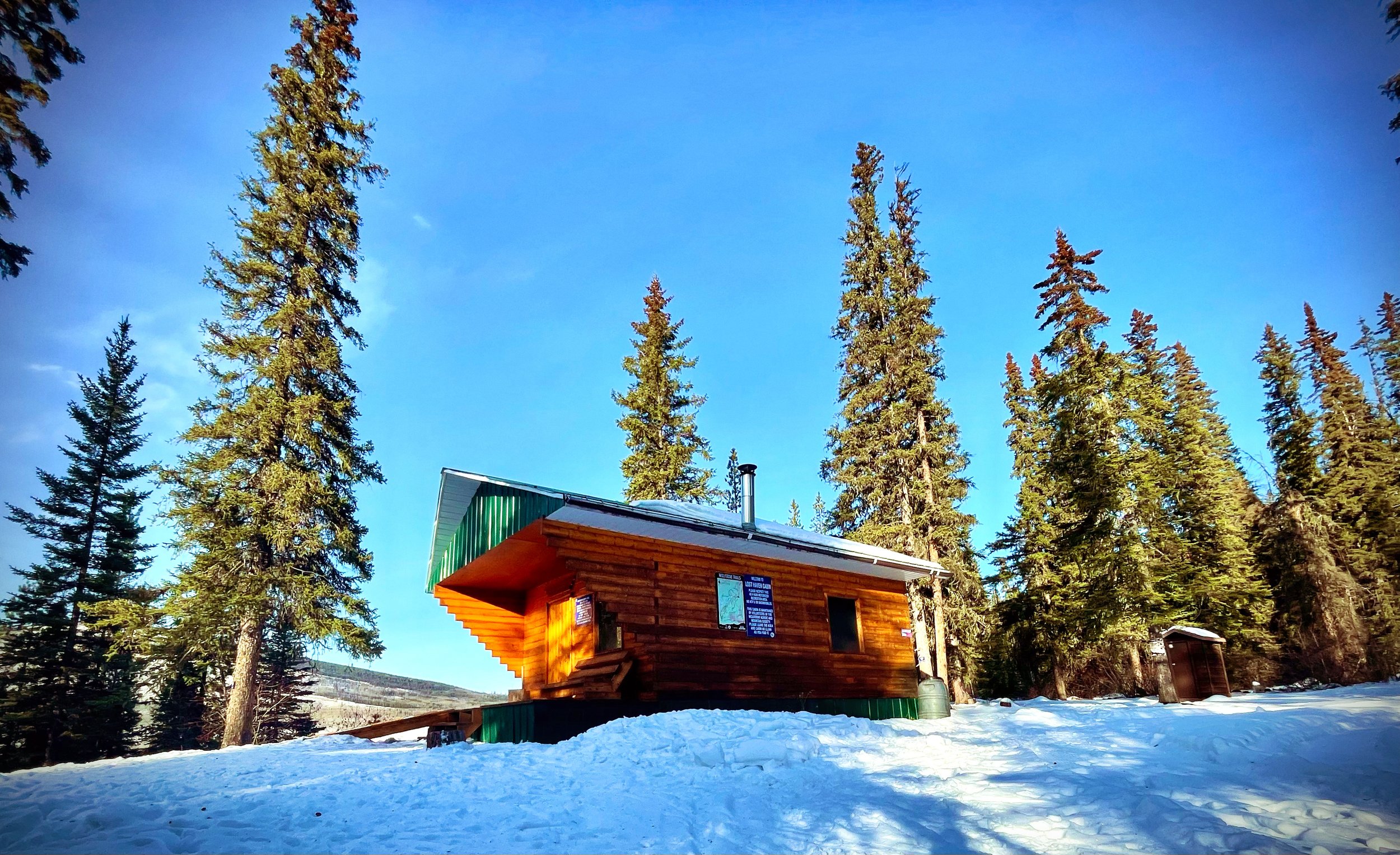
The Wolverine Trails were initially designed for cross-country skiing but have evolved to offer superb hiking experiences near town, culminating at the Lost Haven cabin. Additionally, these trails are well-suited for mountain biking. A segment of the 28-kilometre-long TR Trail, the Wolverine Trails encircle three-quarters of the Tumbler Ridge community. Clear signs along the route highlight its connection to the more extensive trail network
Distance | Time:
6 km return | 2 - 3 hours
Trail Rating:
Easy
Features:
Easy trail close to Tumbler Ridge, great for hiking, cross-country skiing, mountain biking & more.
-

Trails
The Wolverine Trails is a 6 km return to the Lost Haven Cabin and back. The main access is from the golf course. Follow Monkman Way, which turns to the Golf Course Road, leading to the clubhouse and parking. From the parking lot head towards the driving range, follow the “TR Trail” signs downhill, then turn right onto the trail. The trails provide pleasant walking through open spruce and pine forest, and all of the junctions are marked with signs.
-

Trip Link
The Wolverine Trails encompass the Lost Haven Cabin, a cozy stop built in 1996 as a partnership between Wolverine Nordic Mountain Society and Forest Renewal, BC. This trail includes Escher’s Loop, a 2 km loop trail beyond the cabin. Another optional loop is Larry’s Trail and Linda’s Trail, which leads to the valley-bottom where huge Cottonwoods thrive.
-

Geology
The entire area of the trails is a terrace, which is a remnant of sand and gravel deposited by a glacial lake that occupied the valley at the end of the last ice age. The river has cut through this terrace, leaving unstable banks which periodically slump into the river and block its channel.
-

CAUTION
This route is in bear country; travel in groups and make noise.
DIRECTIONS TO TRAILHEAD
There are three access points for the trails. The main access is from the golf course. Follow Monkman Way, which turns into Golf Course Road, leading to the clubhouse and parking. From the parking lot, head towards the driving range, follow the “TR Trail” signs downhill, then turn right onto the trail. See the inset map for details.
Another access is at the Saddle Club. Turn off Mackenzie Way onto Saddle Club Road. Follow this towards the horse stables, taking the left fork and parking beside a large Quonset hut. Follow the signs for the Wolverine Trails, which includes Larry’s Trail and Linda’s Trail.
A third access point is from the ball diamonds. Drive north on Mackenzie Way to the ball diamonds on your left. Turn in here, and drive to the back of the ball diamonds. Park beside the TR Trail sign and follow the marked trail.
thank you to our partners
experience tumbler ridge unfiltered. tag #tumblerridge to show us your adventures.


